Mapping Indiana
Posted on Tue May 06, 2008 at 03:23:00 PM EST
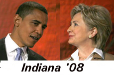
Tags: Indiana '08 (all tags)


Bump and Update: What to look for in Indiana: How well Obama does in three areas, Gary which is 85% African American with a total population of 100,000; Indianapolis, which is 25% black and has a population of 780,000, and the college towns, particularly Bloomington. For Hillary, check the turnout along the Western side of the state under the northern counties and St. Joseph County with South Bend which has a lot of Catholics-- and a population of 265,000.
Here are the official voter registration stats for Indiana as of April 30. Unfortunately, they are not broken down by county.
Politico reports on early turnout: [More...]
More than 160,000 voters cast their ballots early, with large numbers coming in from Obama strongholds in Lake (Gary), Marion (Indianapolis) and Monroe (Indiana University-Bloomington) counties.
Looking at projections, exit polls and results is easier for me with a map. Election results usually come in by county. It's hard to find county maps with the major cities on them. So, I made one for Indiana.
If you don't care for my artwork below, I've also included an Indiana county map and a map of Indiana cities.
All comments about the Indiana primary are welcome here. [Maps below]


| < Obama Surrogate Joe Andrew Flip Flops: "A Miracle If Obama Comes Close In Indiana" | Tonight is Not Just About Delegates > |